The Best Grand Canyon Day Hikes
So you want to hike the Grand Canyon? Let’s start here with the best GrandCanyon day hikes.
The Grand Canyon is one of the most impressive natural wonders in the world and one of the most visited destinations in the United States. However, 98% of all visitors to the Grand Canyon only see this marvel from the Skywalk or one of the many viewpoints along the South Rim like Hopi or Mohave. Less than 2% of all visitors will walk down in the canyon, not even a few feet, missing out on some of the most spectacular views and beauty one could ever see.
There are many different hikes throughout the Grand Canyon for many different skill levels and interests. The sheer size of the Grand Canyon is impressive and by hiking down inside of it you will gain a newfound respect for this natural wonder and witness a viewpoint that many visitors will never see.
I have been fortunate enough in this lifetime to hike over 200 miles of Grand Canyon trails and here is a list (in detail) of my favorite Grand Canyon day hiking trails.
South Kaibab Trail
Location: South Rim
Length: Can be 1 to 14 Miles ( 1.6 km to 22.5 km )
Difficulty Rating: Hard
Permit: No for Day Hikes. Yes For Overnight Camping. Click Here For Overnight Camping Info
Water Refill Spots: None until past the Colorado River in Phantom Ranch ( 13.4 miles/8.3 km)
Best For: Views, An Authentic Canyon Experience, Lesser Crowds, The Fit, And Adventurous
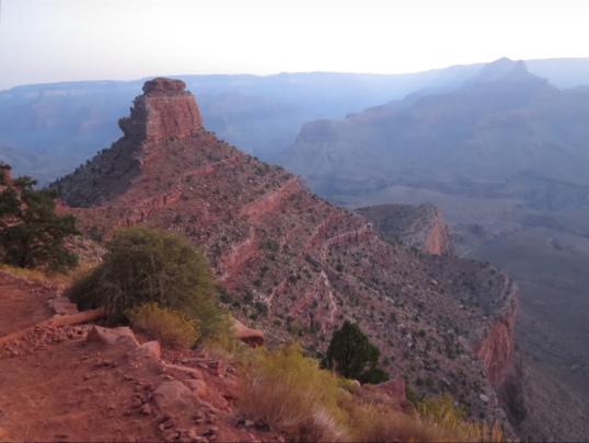
If you want unparalleled views of the canyon and that feeling of being ” one with the canyon” and absolutely one of the best Grand Canyon day hikes period, is this is the spot. The best way to get there is via the free park shuttle that runs practically every 30 minutes throughout the year and stops at several places in the Grand Canyon Village. Times can vary between summer and winter months so be sure to double-check the bus routes. You can click here to see bus times and schedules
When you get to the South Kaibab trailhead you have a few options depending on your fitness level and/or hubris. If you are looking for a nice hike that won’t take all day and a hike that will not work you over start with the 1.8-mile hike round trip (2.9 km) to the Ooh Aah Point. This is a great spot with great views, and it is a fairly moderate hike to this point. If your fitness and time are beckoning you to go further you have a few more viewpoint options you can check out. You have Cedar Ridge (1.3 miles or 2 km past the Ooh Aah point ). If you add another 1.2 miles (1.9km) from Cedar Ridge you will arrive at Skeleton Point. If you decide to go past Skeleton point I hope you are in good physical condition because it is another 1.7 miles ( 2.7km) down to the Tipoff Point and that would make the total trip at least 9 miles or 14.50 km RT from the S Kaibab trailhead and it is hella steep. From there. for the adventurous and the physically fit, you can finish it off by crossing the extremely cool footbridge across the Colorado River to Phantom Ranch. This would make your trip a whopping 16.7 miles (26.9km) and its no joke. You will feel this the next day.
Fortune favors the bold: Your reward for reaching the Colorado River is the cool footbridge
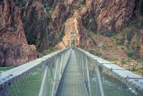
Tip: Instead of returning up the S Kaibab trail you can connect with the Bright Angel Trail and hike up that. It’s not as steep and has several water stops. If you can do all that in one day you have earned your hiking stripes
A Word of Advice. This trail along with 99.9% of the trails in the Canyon is very steep. You will exert an incredible amount of energy walking downhill. If you have ankle or knee problems, I recommend wearing a brace and if you have trekking poles use them. It is also not recommended to hike to the Colorado River and back in one day, doable yes, recommended no. As they say in Grand Canyon language ” What goes down must come up” so remember whatever you go down or however far you go down you will have to walk back out of there.
Bright Angel Trail
Location: South Rim
Length: Can be 1.5 miles to 18 miles
Difficulty Rating: Hard
Permit: No for Day Hikes. Yes For Overnight Camping. Click Here For Overnight Camping Info
Water Refill Spots: Yes
Best For Cool tunnels dug out of the rock, tons of Big Horn Sheep sightings, nice views
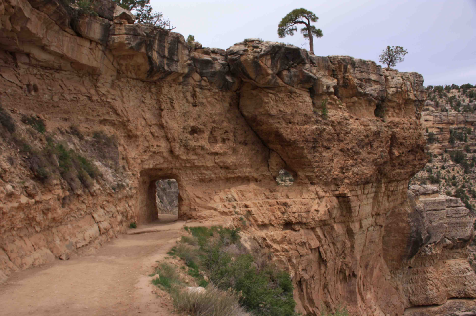
The Bright Angel Trail is the most popular Grand Cayon day hikes trail in the park which means it will be the most crowded, especially at the top. However, the Bright Angel Trail has some modem conveniences to help aid your hiking journeys such as rest stops, restrooms and water refill areas on the way down. You can get to this trail via the free shuttle bus You can click here to see bus times and schedules or depending on where you are staying in the park you can walk to it
Even though the Bright Angel Trail is popular doesn’t mean it’s easy, this trail is no joke either. Some of the great features of this trail are the cool little tunnels like you see in the above photo that is dug out of the rocks and those start early in the trail so you will not have to hike tons of miles to see that. Also, if the Big Horn Sheep of the Grand Canyon were writing this post this would be their favorite selection because they are everywhere on the Bright Angel Trail. If you love animals in their natural habitat this is a good pick.
When you get to the trailhead you can start with the 1.5-mile hike to the Rest House. This makes for a decent little day trip and there is a water fill-up area and restrooms at this location From there you can hike another 1.5 miles to the next Resthouse where you will be rewarded with more views, another water stop, and more restrooms If you are still feeling good you can hike the extra mile or so to Indian Gardens with, you guessed it, more views, another water stop, and more restrooms. If you turn around from here your total trip will be 8.5 miles
From here if most people decide to continue down the Bright Angel trail their intent is to make it to the Colorado River. However. there is a side trail here that can take you to an unbelievable spot call the Plataea Point. Here you will get an amazing view but you can not reach the Colorado River from here unless you are a Big Horn sheep. Plateau trail map here
Another 3.2 miles from Indian Gardens will get you to the base of the Colorado River and there is a rest stop at the base as well. From there you can either turn around, walk across the footbridge, which I recommend since you came all that way, stop at the Phantom Ranch and return up the trail or if you are feeling at this point like you want more of a challenging hike up the S Kaibab trail but I do not recommend that. No matter the length you chose this is one of the best Grand Canyon day hikes
Here is the complete trail map to Phantom ranch
Hermit Trail
Location: South Rim
Length: 3.5 to 15.5 Miles
Difficulty Rating: Hard
Permit: No for Day Hikes. Yes For Overnight Camping. Click Here For Overnight Camping Info
Water Refill Spots: Yes
Best For: A less maintained and traveled trail
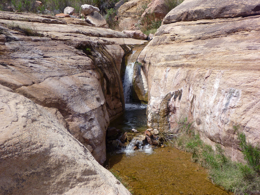
If you are looking for a little more solitude away from the crowds Hermit Trail is a great choice You can get to this trail via the free shuttle bus You can click here to see bus times and schedules or you can drive directly to the trailhead. However, private vehicles are only permitted to drive here between mid-September and mid-May all day hikers have to use the free shuttle service.
You can begin with a nice day hike and head 1.7 miles ( 2.4KM) to Santa Maria Springs, it has a cute stone shelter that is great for pictures and it has a permanent spring .( You can also combine this hike with the Dripping Springs Trail See map here but you will have to do some backtracking ) If you hike 3 miles down from Santa Maria Springs there is nice panorama view over the inner canyon gorge, and then you will reach the Cathedral Stairs. From here you have roughly 3 miles before you get to the Colorado River. Note Santa Maria Spring, and Hermit Creek has permanent water sources but you should filter the water to be safe.
There are many variations to the Hermit trail. You can connect it with the Boucher Trail, the Tonto Trail to Granite Rapids, and you can even connect the Tonto Trail to the Bright Angel Trail.making this one of the most versatile Grand Canyon Day hikes. Most hikers will take the Hermit trail down and the Boucher trail up. The other connections can be done in a day but are both more than 20 miles and are best for overnight The Because of all the variations you can click here for the complete map and distances
Rim To Rim
Location: Grand Canyon National Park, South Rim
Length: 22 to 47.5 mile round-trip out-and-back
Difficulty Rating: Difficult
Permit: No for Day Hikes. Yes For Overnight Camping. Click Here For Overnight Camping Info
Water Refill Spots:
Best For Advanced hikers looking for a challenging backpacking trip
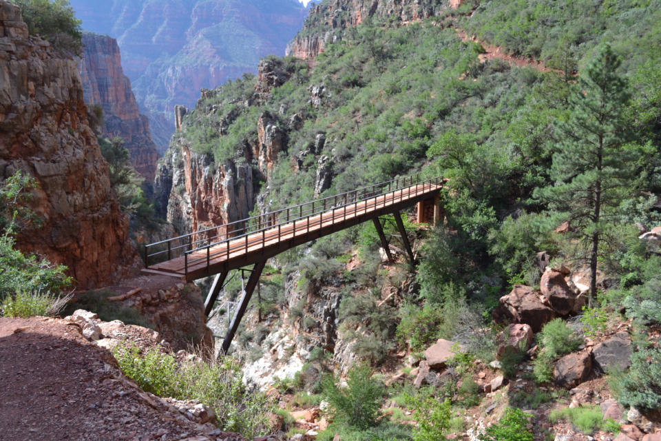
The Rim to Rim trail is one of a kind and one of the best Grand Canyon day hikes. This hike allows you to see the vast differences between the North and South Rims. Although separated by just 22 miles in distance the North and South Rims are like two different worlds. The South rim is more barren and a lot hotter whereas the North rim has cooler temperatures and is lush with trees. Since 98% of all visitors see only the South Rim of the Grand Canyon where all the shops and restaurants are located, the North rim will be far less crowded and offer a completely different viewing perspective.
The most popular way this trail is used as a day hike is by taking a hiker bus or charter shuttle to the North Rim and hiking back to the South Rim. (You check bus times and rates here)
This is on the upper echelon of day hikes totaling 22 miles. so, you will be at this all day. Keep in mind that even though its only 22 miles distance from South Rim to North Rim it is a 4+ hour bus ride. That is because there is not a direct road from one side to the other, you have to go all the way around the canyon and then back down to the North Rim Trail Head. Although long and grueling with the added travel time by vehicle, the juice is worth the squeeze on this hike. Rim to Rim trail map here
On a side note, this is a great trail for an overnight backpacking trip. You can arrive at the North rim in the early evening, get a good night’s rest, and hit the trail early in the morning. If you choose to backpack this make sure to stop at Ribbon falls along the way. It is a few miles additional, but this is an amazing waterfall that few people take the time to see. If you are there – see it!
Tanner Beach To Beamer Trail
Location: South Rim
Length: 3.5 to 15.5 Miles
Difficulty Rating: Hard
Permit: No for Day Hikes. Yes For Overnight Camping. Click Here For Overnight Camping Info
Water Refill Spots: No
Dogs: No
Best For Isolation, solitude, and the emerald waters of the confluence
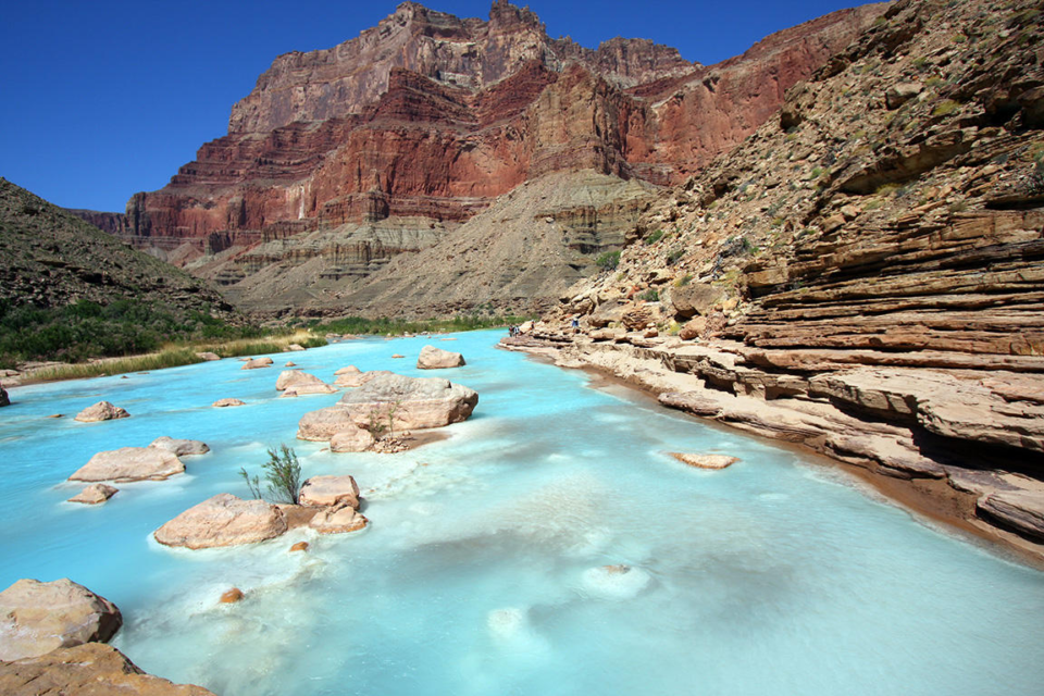
Tanner beach to Beamer trail to me is the secret gem of the Grand Canyon making it one of the best Grand Canyon Day hikes. Seeing the emerald waters of the confluence up against the mighty canyon walls is breathtaking. The Tanner Beach trails lack popularity amongst the other Grand Canyon Trails. Much of that has to do with both trail distance (up to 30 miles round trip) and distance from the Grand Canyon Village (23 miles) However, fortune favors the bold. This trail is rugged and has no water stops but the views and the serenity value from this trail are absolutely amazing. I would not recommend you hike the whole 30 miles round trip in a day. but there is plenty to see on the way down if you want to trek a mile or 3 and turn around. You can be the judge. The views and solitude will not disappoint. Even though this trail should be done overnight there is still a lot to see even if you do what you can within the day. As with most Grand Canyon trails you can connect this trail to many other Grand Canyon trails. You can even hike this back to the Bright Angel trail if you wanted to but that would take a couple of days. So, if you are looking for an overnight backpacking trip too without the hassle of congested lotto permits this place is perfect. Here is the full trail map with variations
In truth, every Grand Canyon trail is a winner. You simply can not pick a bad trail.
BONUS: Additional Resources
What to pack on your day hike: My complete checklist and recommendations on what to take on your hike
Gear: A list of my favorite hiking and backpacking gear.
